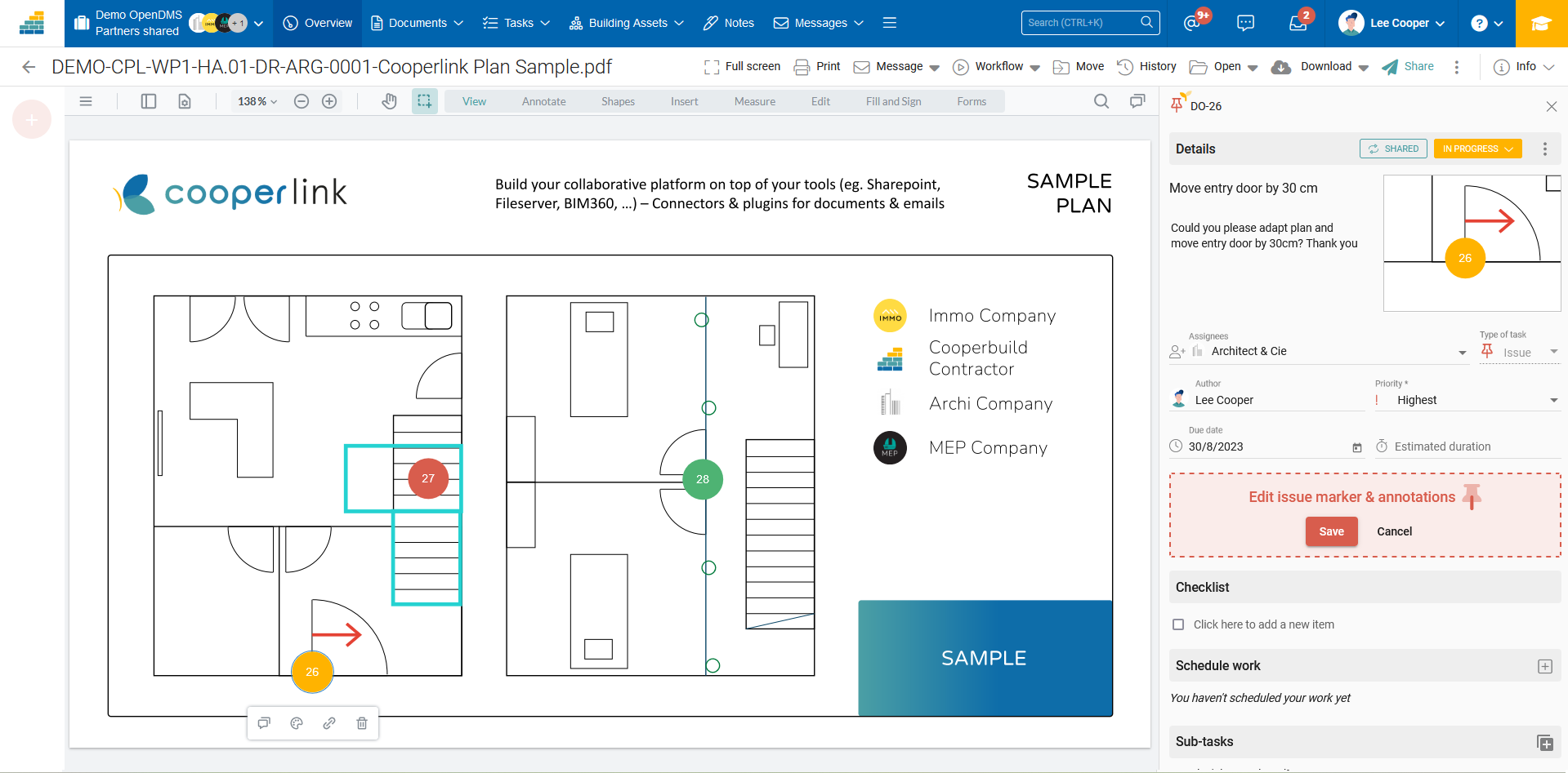
Annotate and create observations on plan
The geolocated pointer tool allows you to identify an area of interest on the plan or PDF document, to annotate it with many tools (arrows, geometric shapes, texts, ...), and to create a task / issue for one or more users.
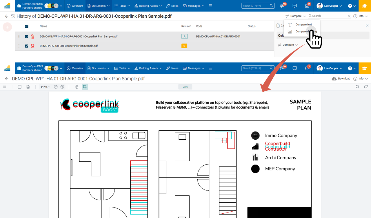
Comparison of plans and/or documents (PDF)
Whether in document management or during an approval procedure, the plan or document has been modified and you are not sure where? Keep an eye on all the changes made using the plan comparison tool. The tool has two modes of operation:
- Text comparison (additions, deletions)
- Graphical comparison (layer-on-layer)